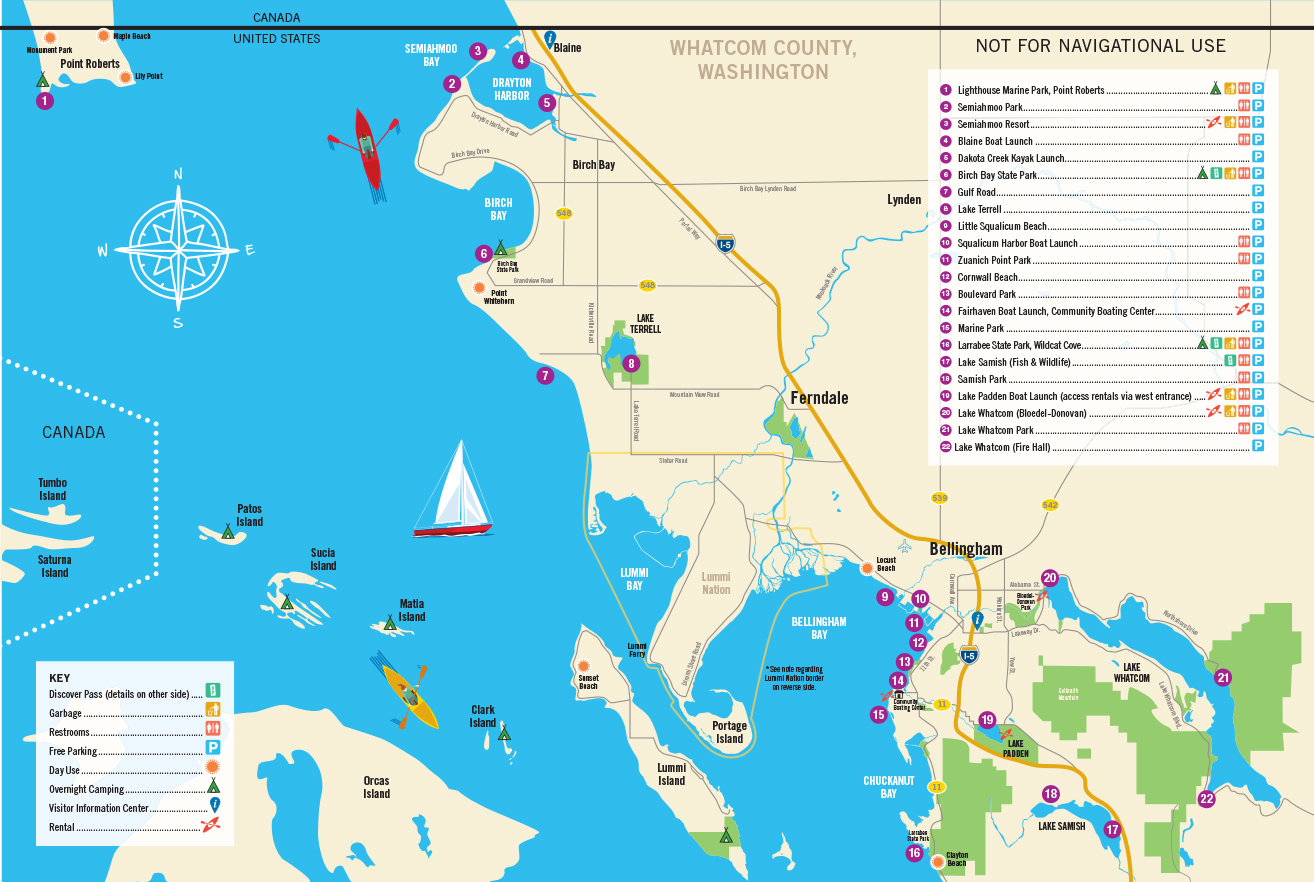
The Port of Bellingham has created a water trail map to promote water access along Whatcom County’s marine shoreline and freshwater lakes.
The first version of the Whatcom Water Trail map is intended to promote our region as a water sports destination and an initial step in a longer-term process. Stakeholders will continue working with local landowners and engaging the public to identify key locations and prioritize improvements for safety and access. Future versions will include river access points.
Gina Stark, project manager with the Port of Bellingham’s Regional Economic Partnership, led the project with help from Recreation Northwest, Kristi Kucera of Moondance Sea Kayak Adventures, and local public land agencies. Credit for support of the map goes to Port of Bellingham commissioner Michael Sheppard for recognizing the value of public access to our waterways.
“This has been an amazing cross-agency collaboration, working with city of Bellingham parks, city of Blaine, Whatcom County parks, Washington State Parks, DNR and Lummi Nation,” Stark said.


